Inti Punku: Hiking to the Sun Gate in Ollantaytambo
The first thing to know about the hike to Inti Punku in Ollantaytambo is that it’s an absolute beauty. The second is that you should start early. Having recently completed this memorable walk from Ollantaytambo town, I wanted to share my experience and a few tips.
During our family gap year we spent a week in Ollantaytambo, a laid back town in Peru’s Sacred Valley. There’s a lot to see and even strolling lazily through the Qosqo Ayllu section of town is fascinating. There are several sets of ruins within walking distance of Ollantaytambo but if you’re up for a bigger walk, Inti Punku is worth the effort.
Inti Punku meaning
The Quechua word Intipunku translates roughly to “puerta del sol” or “gate of the sun.” The Inti Punku in Ollantaytambo is one of several so-named Incan structures (the most famous of which is situated atop Machu Picchu…but don’t confuse the two). The site had astronomical as well as military significance.
Highlights of the hike from Ollantaytambo to Inti Punku
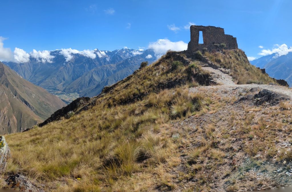
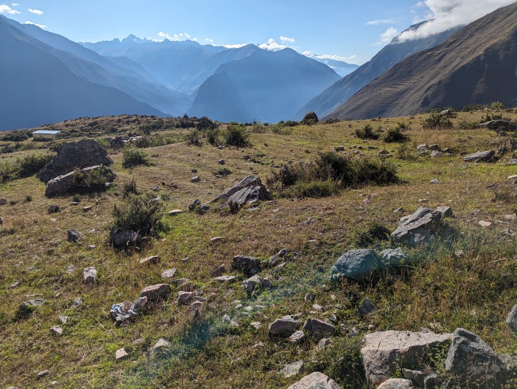
If you love hiking you’ll likely agree that it’s more about the journey than the destination. In this case, both are memorable! By now you’ve probably seen photos of Inti Punku, and hopefully they’ve captured your imagination. Let me assure you though, the hike from Ollantaytambo up to Inti Punku offers a lot more than the sun gate itself.
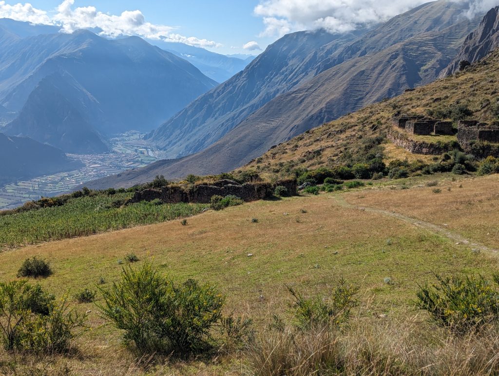
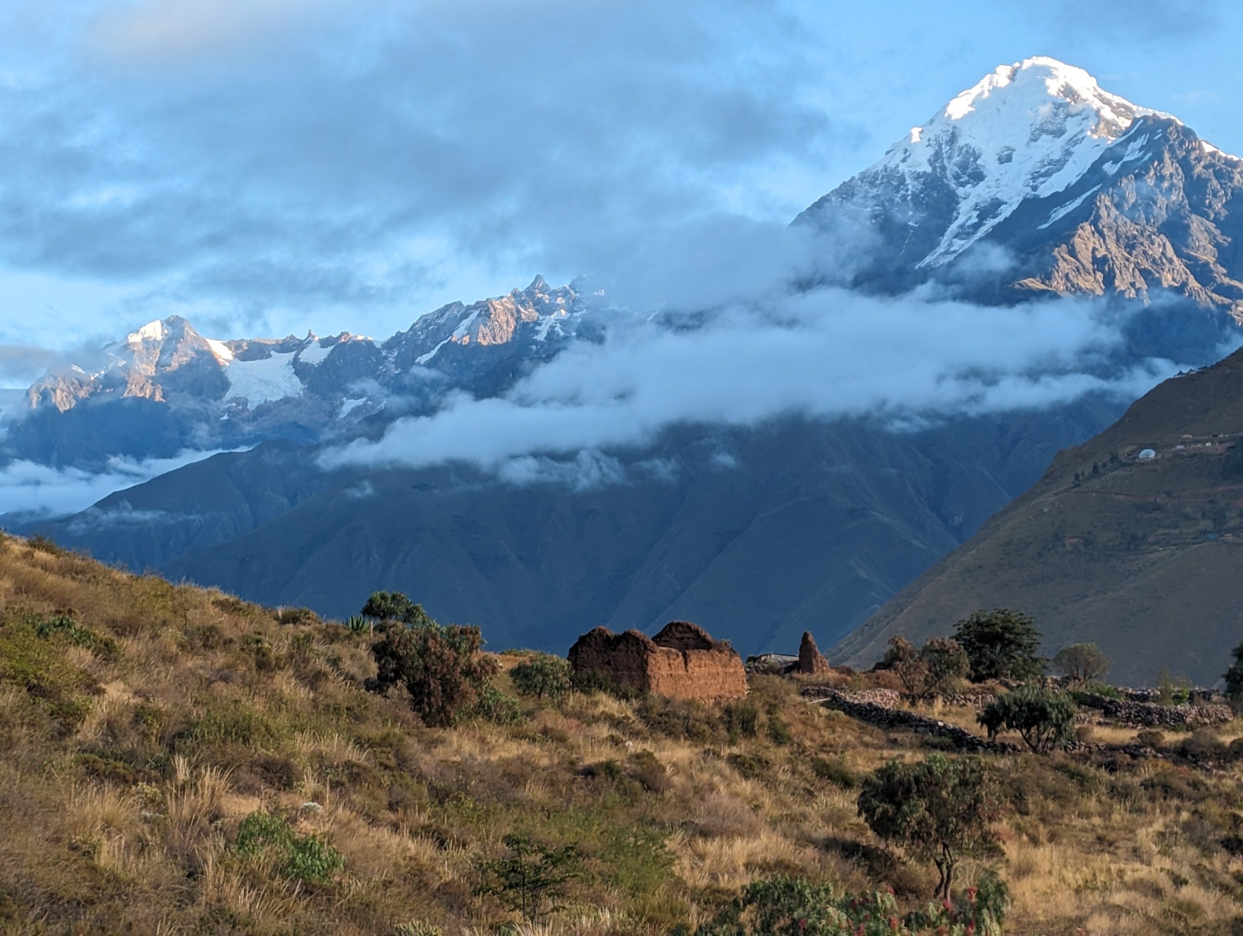
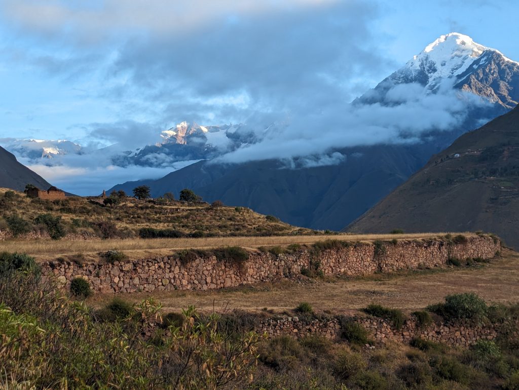
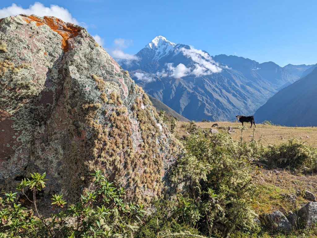
This isn’t a walk through the woods so don’t expect much shade. The upside of that is that you’ll be able to enjoy nearly unobstructed views of the valley and Mt. Veronica throughout the hike (weather permitting of course). There are multiple small ruins along the way and massive boulders in a quarry area that the Inca themselves worked. Bright flowers stand out against grassy hills, sometimes growing from the cracks of ruins. You may see some goats, chickens, and cows roaming around the farmland you’ll pass on the way.
On the day I hiked there were very few other people around. And of course there’s the iconic sun gate. It’s a hike worthy of many stops.
Preparing for the hike
Depending on exactly where you start this will be about an 11-mile hike, round-trip. I recommend waking up early in Ollantaytambo and starting from there. (Note: there is an alternative route from Cachiqata but I don’t recommend it. Although it’s said to be “faster” the way is steeper and less rewarding.)
The trail starting across Puente Inka is well-marked and maintained. It’s also quite smooth terrain. However, almost the entire way to Inti Punku is uphill so it can feel grueling. And there are scant opportunities to take cover from the sun if it’s not cloudy!
With this in mind, I recommend (along with every local I met) starting very early. I started from Ollantaytambo town at 5:30am and was back before 1pm. It took just over seven hours including a long-ish break up top but I was moving very fast! If you can start at 5am or earlier the sun won’t be a big factor for a couple of hours. It’s also quite magical to walk through Ollantaytambo (especially if you stay in Qosqo Ayllu) while it’s still dark and the town is just stirring. You may not be a morning person but, trust me, you don’t want to do this whole hike under the sun. I’d suggest allowing 7-10 hours in total.
I brought some fresh local bread, a hard-boiled egg, an avocado, fruit, nuts, and two liters of water. The water was just barely enough as I was pretty thirsty at the end. You’ll want more than a bag of trail-mix for this one. Sunscreen to re-apply along the way, layered clothing, good shoes, hat, raincoat or poncho just in case. I was fine with a t-shirt, long-sleeved shirt, and light jacket but the morning was a little chilly so you may want an additional layer. I wasn’t sure if it would get windy and cold up top. It wasn’t cold up there on the day I hiked but of course this will depend on the day and the amount of cloud cover. Have some layers.
How to get there
From Ollantaytambo follow the roads to Puente Inka (Inca Bridge). Don’t do what I did and try to cut through some farms: this will put you on a precipice far above the bridge with no clear way to get down. Stick to the car roads. It only takes about 15 minutes to get to the bridge.
Across the Inca Bridge you’ll see a sign for a bike trail but ignore this and head up the road to the right. You’ll see a sign mapping the hike, which can be made into a longer journey with camping if you’re looking for something bigger.
The road rises above the river. Early on you’ll cross a small red bridge. You’ll soon see ruins near the town’s stadium on the banks above opposite side of the river, followed by the train station down below. By this point you’d have a hard time getting lost as the trail is quite well worn. There are a few splits where a path might lead downwards towards a farm but you want to continue upwards. Arrows occasionally mark the way and in a few open areas of land the trail is lined by rocks. As you get closer to Inti Punku you’ll be able to faintly see it on the ridgeline.
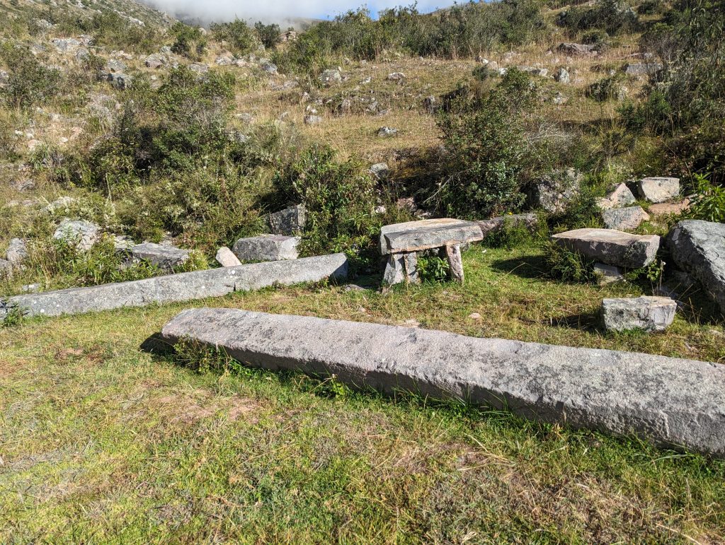
The only time I felt slightly unsure about the trail was near the Canteras de Cachiccata, whence the Inca quarried many of their rocks for nearby structures. Here the trail gives way to open fields and it’s quite beautiful. You can meander a bit. When you’re ready to continue upwards look out for rocks lining the trail or simply keep an eye out for the more worn path. It’s hard to miss.
Other hikes from Ollantaytambo
Pachar to Cachiccata (two nights camping)
As depicted in the low quality image below, you can extend this hike into a longer one with camping. In this case you’d start from Pachar (or perhaps end there and enjoy a beer at the Cervecería del Valle Sagrado). Check with a local guide and / or the tourist office in Ollantaytambo for more information.
Pumamarka
The walk from Ollantaytambo to the Pumamarka ruins is another one we’ve heard great things about. Many reviewers have commented on the hike itself being worth it even if you’re less interested in the history. Estimates put the hike at around two hours (one way), or you can take a taxi most of the way. Bring a few soles as there’s an entry fee.
Huilloc
The trail through Pumamarka continues upwards to the community of Huilloc, where you can spend a night or more hosted by a local family and learning about their traditional practices. A good option would be to take local transportation to get there and hike back down to Ollantaytambo via Pumamarka.
Pinkuylluna
You can see these qolqas (or grain storage structures) from many parts of Ollantaytambo town. It’s one of those images that just entices you to climb up. And you can! And it’s free! But beware! It can be a bit steep at times. That said, the way is not long.
Qelloraqay Archeological Site
This is not so much a hike as a walk through town plus a short trail but quite a nice place to kick around for a bit. When I visited a few locals were relaxing and reading near, or among, the ruins. Take the road back alongside the stadium, after which a path turns towards the left behind the stadium. At one point the Pinkuylluna qolqas will be framed by the bleachers. Continue until you see the ruins in front of you up a small embankment.
Inka Watana (requires paid visit to the main ruins in Ollantaytambo)
If you’re in Ollantaytambo you’ll doubtless be visiting the main ruins above town. Up top there’s an option to hike up to Inka Watana, part of the ruins set a bit higher on a hill, requiring a hearty walk. This short hike took me about 15 minutes from the main area of the ruins (after which I was quite out of breath). You’ll see a row of stone indentations in a wall where unfortunate souls were tied up for the sake of punishment. At least they will have had a nice view.