Cafayate to Cachi via Route 40
After spending a couple of days in Cafayate, a cute town in a wine region, our plan was to go to Tafí del Valle, a town about 150km south of Cafayate. The region around Tafí has more humidity, which makes for beautiful green mountains.
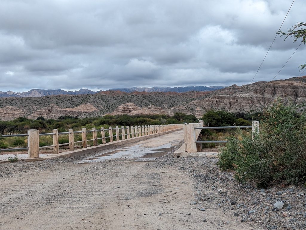
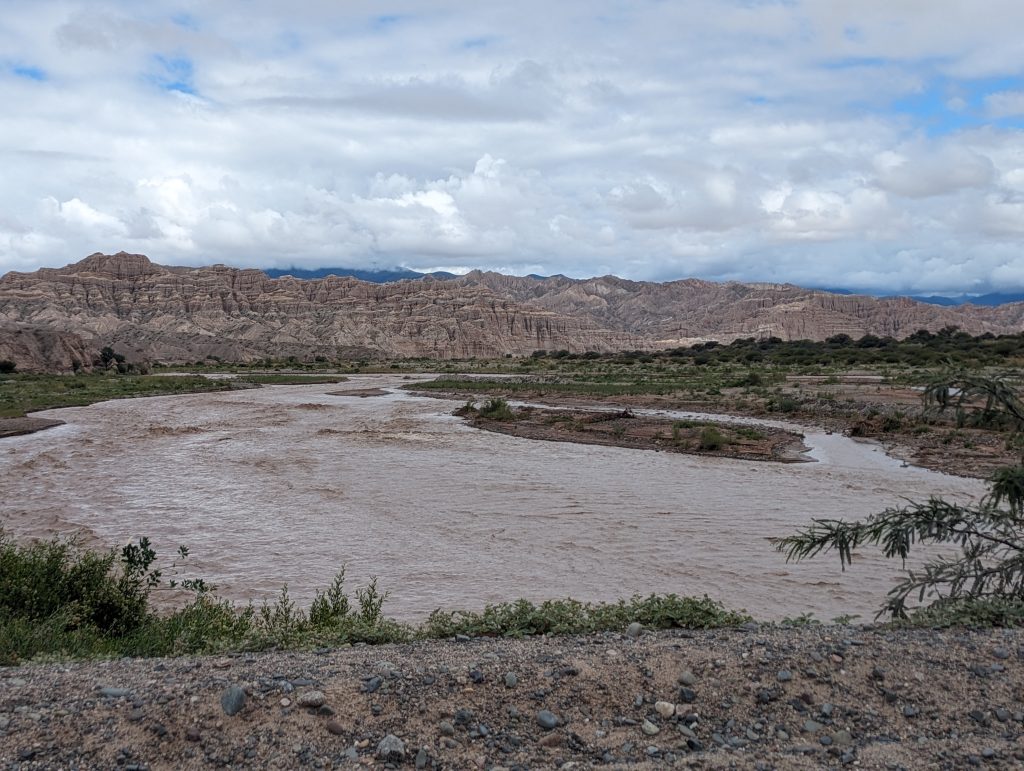
Upon starting our journey from Cafayate, we reached a bridge over Rio Santa Maria, just to find out that the rain had damaged it and it was out of service. We would have had to take a detour through a different bridge over the same river, but there was no guarantee that the it would be operational the next day when we needed to head back. So we had to make a decision on the spot to cancel the trip to Tafí and head for our next destination: San Carlos, north of Cafayate. This would bring us a bit closer to Cachi than staying in Cafayate again with the added benefit of experiencing a new town.
San Carlos
San Carlos is located 25km north of Cafayate. It is not a touristic town but any means, but it is the end of the paved road between Cafayate and Cachi, so for us it meant a place to stop, rest and plan the next leg of our trip. We were lucky to have reserved a room in Casa de Los Vientos, a rural inn. We were a bit disappointed to have canceled the trip to Tafi, but when we arrived at the inn the host gave us a warm welcome, a cup of coffee and a cozy room, and we were generally impressed with the space. The inn was the main highlight of our stay in San Carlos. It has only seven rooms and has been designed with permaculture techniques which allow the use solar power for heating in the colder months. The place was built with local materials (mainly adobe and wood) and combines traditional construction methods with modern designs.
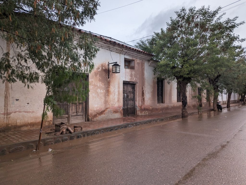
The town itself is very quiet, and looks enchanting with old adobe houses stained with red as the rain removes the construction minerals. We went on a Sunday and everything was closed but we found a little store that sold us some humitas and empanadas for dinner, which we ate outside the store overlooking the rainy plaza.
The town has an information office where we asked about road conditions for the next day. It had rained, so we received a few words of caution but we decided to move forward.

Route 40 between San Carlos and Cachi
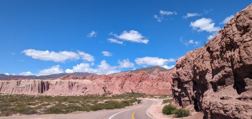
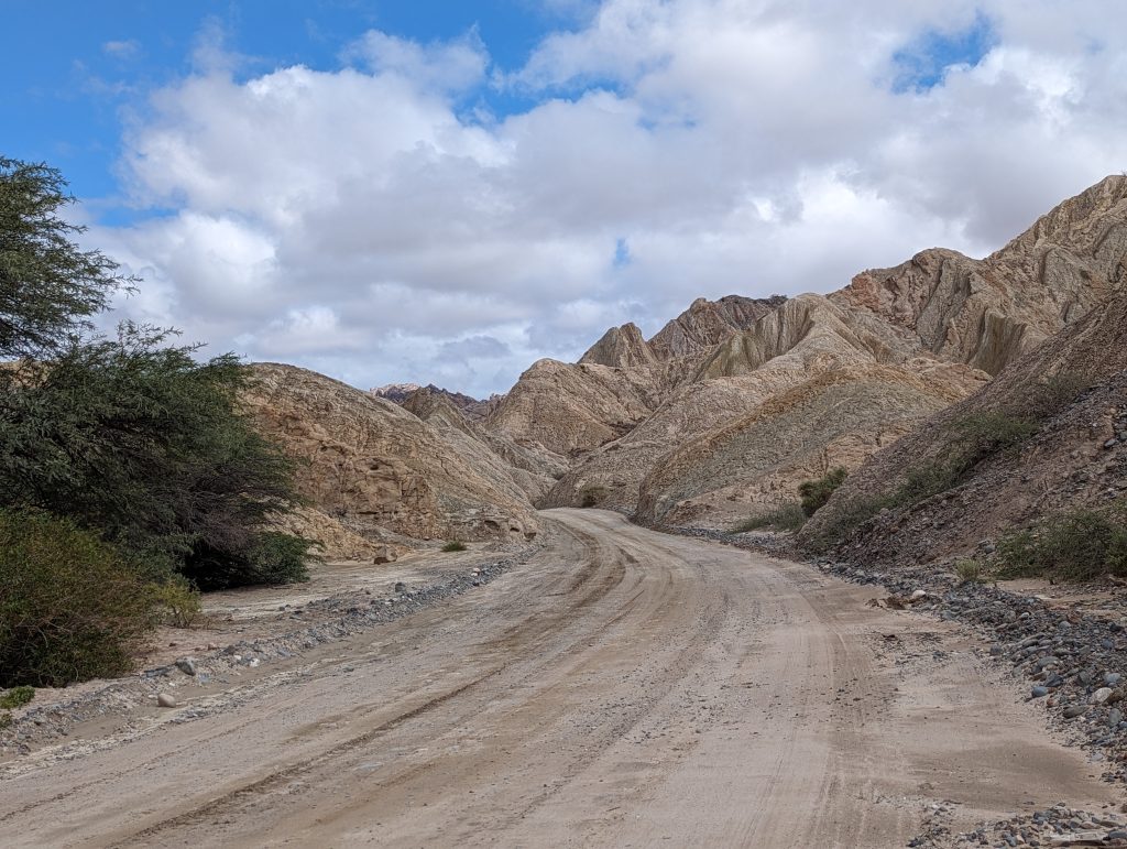
The whole trip is 135km (84 miles). Google estimates it can be done in 3.5 hours but Google estimates are generally unreasonable in this region considering road conditions. It took us 6.5 hours to complete it, including a one hour stop for lunch and stretching. The main reason for our slow going is that the road gets eroded by the rain, forming a saw-like shape known as serrucho. Basically it is like riding over a speed reducer over the course of 50 miles, non-stop. We were warned that there might be some river crossings given the rain the day before, but it wasn’t the case. All the rivers we crossed were dry, and all we found on the way were some puddles. We passed several cars on the road, houses very often and occasional telecom poles for emergency calls. Although it sounds like a remote place, there were resources if anything would have gone sideways.
Putting aside the fact that my brain still vibrates when I think of that road, the landscape made for one of the most spectacular drives we have done!
San Carlos – Angastaco
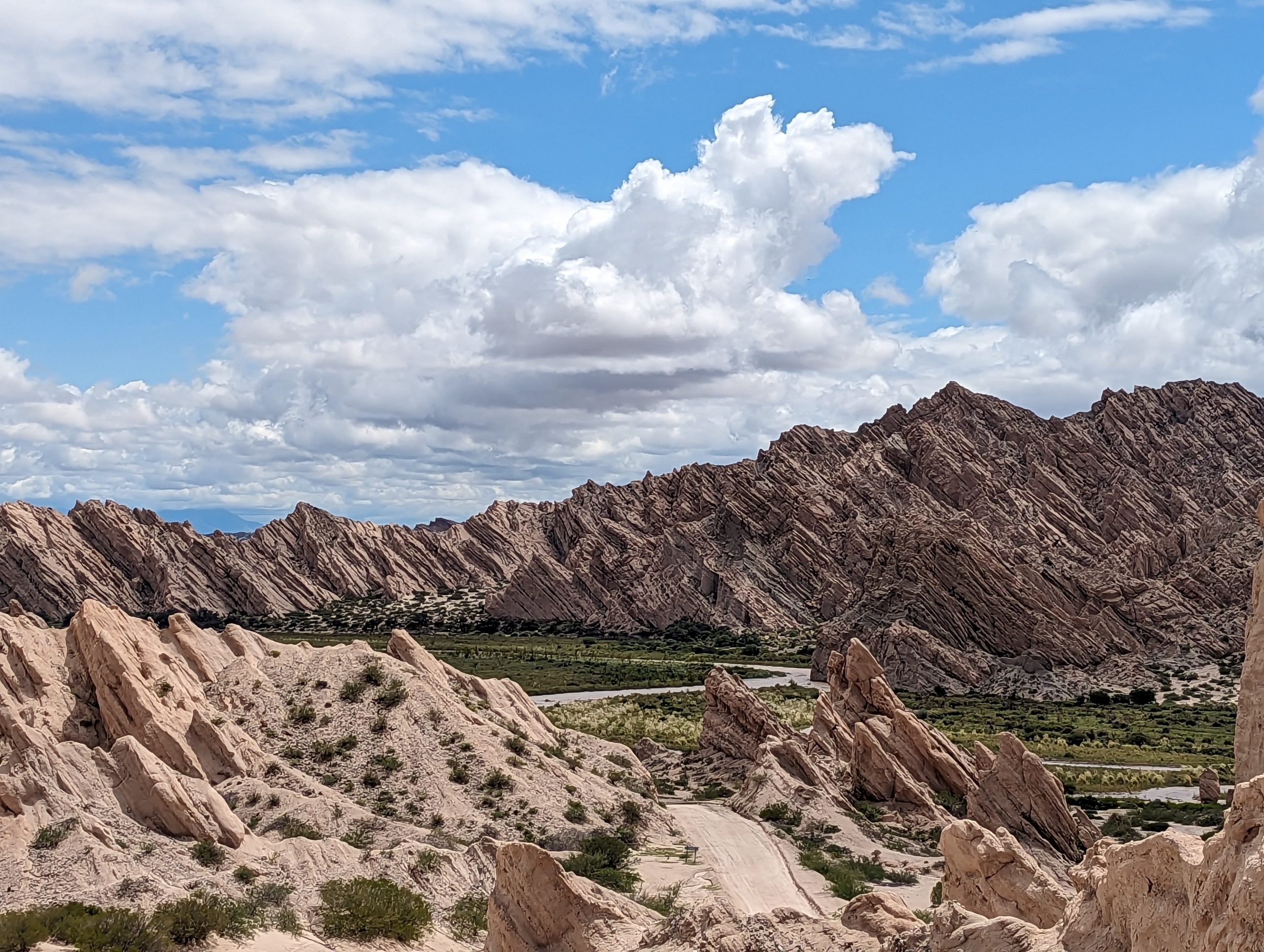
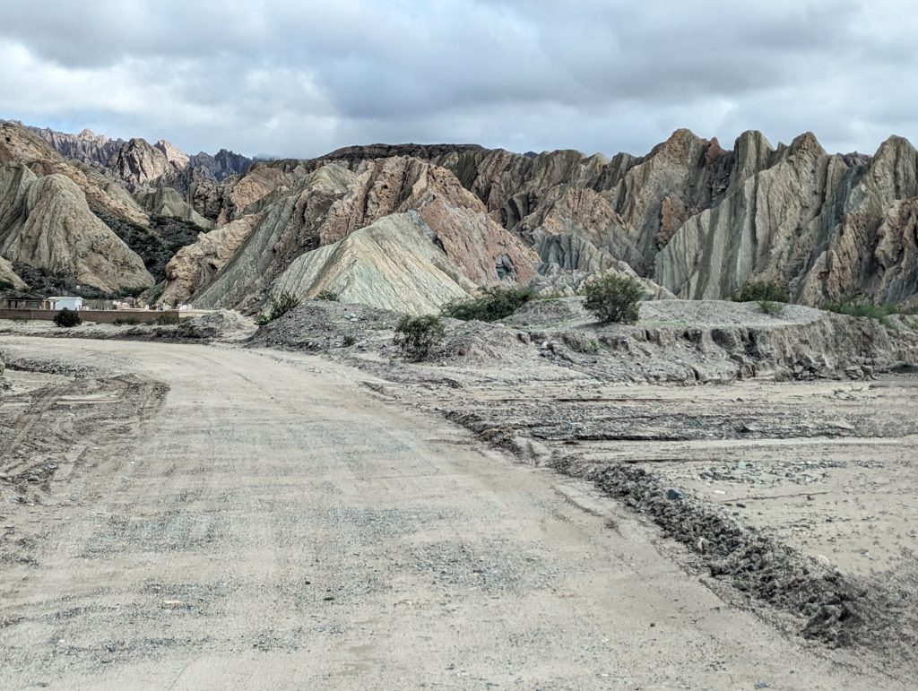
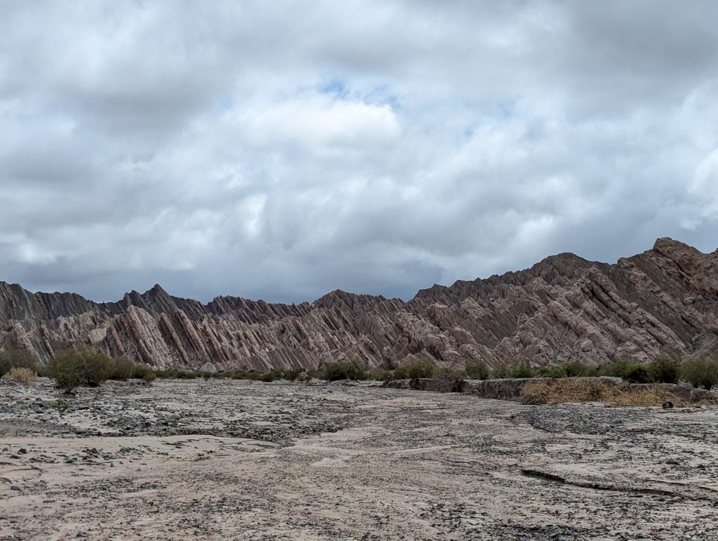
About 20 minutes after leaving San Carlos, the landscape starts showing white-yellowish rock formations. This section of the road took us about two hours, and the rocks get very dramatic as the road enters Quebrada las Flechas, where the stratified mountains reach diagonally skyward. The landscape is magical. It has a sense of isolation yet the farmers living nearby are a reminder of the harmony we can have with mother Earth.
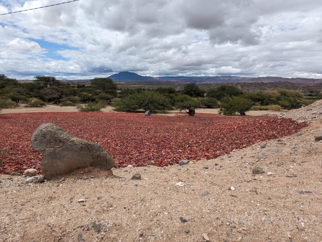
This region has several crops including red pepper. The area has the ideal dryness and light to produce peppers of uniform red colors. The farmers dry the peppers in the sun, and then grind them and pack them. These are use for local consumption and exports and you can find products including good paprika in Cachi.
Angastaco – Molinos
Angastaco is surprisingly active considering its remote location. We had a generous and satisfying lunch in a restaurant called “Pacha” and our daughter got to play at the nearby playground before we continued our trip. From Angastaco to Molinos, the serrucho or rutted quality of the road was pronounced, and our speed was about 20km/hour. Here the landscape started to change, moving along the valley of the Rio Calchaqui with red and green mountains in the background. We saw herds of cows and sheep along with some crops.
Molinos – Cachi
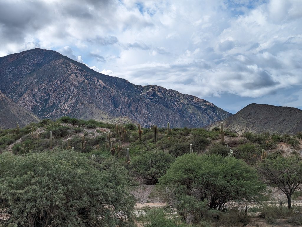
The road conditions here got better, but the road had a lot of curves. This section of the road is more populated, with a few villages and constructions close to the road. There are some open views to the valley and the distant mountains.
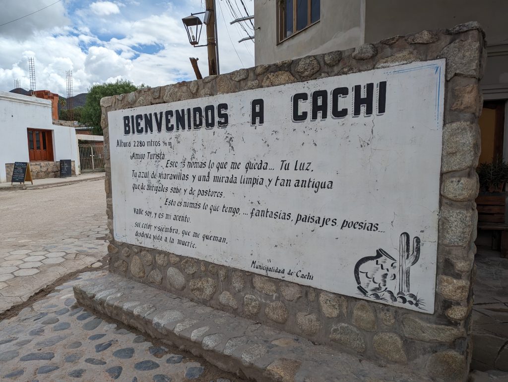
We arrived in Cachi late that afternoon, completely exhausted but with a big smile in our heart. If you happen to be in this region, please do not get discouraged by the road, and embark on the journey if the conditions are favorable.
Want to learn more about our experience in Salta province? Check out our Salta blogpost!